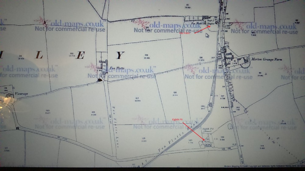
Pea Flatts and Eighth Pit 1874 map
Highlighted in red the locations of The Pea Flatts (top) at approx. grid ref NZ307495, which appears to have taken its name from the nearby farm (left) and below this The eighth Pit. at approx. grid ref NZ307491,Parts of The Wagonway can still be traced around these former mines. To the North it originally headed past The 7th Pit and 6th Pit. whilst heading South West takes you toward George Pit and later Charles Pit. The A1M cuts through the former railway and sadly Not much remains of these pits.

This photograph is by lyons and was uploaded October 16th 2016. © lyons please do not copy or distribute without prior express permission.
Rating
Nobody has rated this photograph yet, why not be the first?
Copy & Paste Forum Code
To display this photograph in a forum message please copy the text below and paste it into your forum message:
[photo]108746[/photo]
To display this photograph in a forum message and link to the full size image please copy the text below and paste it into your forum message:
[link]108746[linkphoto]108746[/linkphoto][/link]