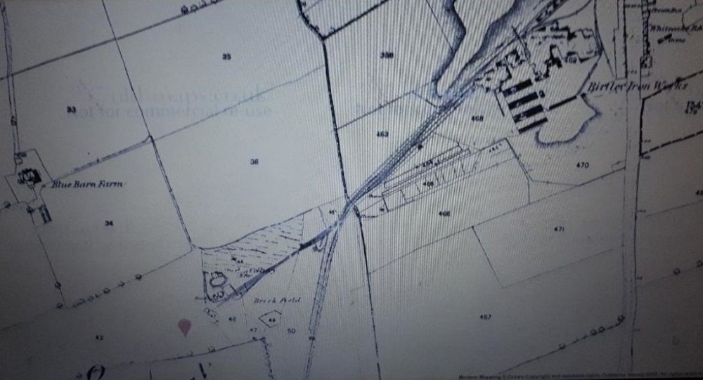
Ouston E pit 1860 map
The Durham Mining Museum http://www.dmm.org.uk/colliery/o001.htm#top lists this mine as Ouston which covers The A pit.
The B pit or "Busty" appears to be The Urpeth Pit see https://www.aditnow.co.uk/Mines/Urpeth-Busty-Coal-Mine_8677/ and nearby Low Urpeth. which must be the missing C and D Pit making The E pit the youngest of the group.
The Wagonway that runs of bottom of picture leads to Ouston (A) Colliery grid ref approx. NZ264537. (Ouston Villa Farm) not listed by 1960 maps. On Aerial views only the odd marks on the ground.
New Winning grid ref approx. NZ265533 This mine is not mentioned but a wagonway leads south from The A pit. It was situated factory units within The modern day Drum Industrial Estate.
Ouston E Colliery is now Westline Industrial Estate, it still retains a number of Buildings, though in a neglected state is still worth a visit.

This photograph is by lyons and was uploaded February 5th 2019. © lyons please do not copy or distribute without prior express permission.
Rating
Nobody has rated this photograph yet, why not be the first?
Copy & Paste Forum Code
To display this photograph in a forum message please copy the text below and paste it into your forum message:
[photo]117051[/photo]
To display this photograph in a forum message and link to the full size image please copy the text below and paste it into your forum message:
[link]117051[linkphoto]117051[/linkphoto][/link]