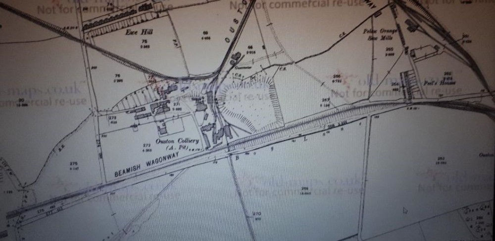
Ouston A 1896 map
Map shows The A pit to be in the centre of Wagonways from nearly all directions, The Middle line came from The E pit. This then swings by heading North West to Urpeth pits. You will note the line running down to the bottom, This was The "New Winning Pit" This isn't really mentioned on the Durham Mining Museum Website http://www.dmm.org.uk/colliery/o001.htm#top but is listed in the employment area.
The main Railway running past (Beamish Wagonway) runs over the top of the New Winning line. Note bottom left looks like a "old Wagonway" However later maps list it as Foot Path. This linked up with the junction at Pelton Fell/ Colliery.
Some of the Buildings to the left of the site are still present. one of which is stone built possible workshops? is now used by the farm. Also The large House just above the word Ousten could have been Managers House?
Also the row of housing "Ewe Hill" which shrinks in size by 1939 map Disappears by 1960 map. There is no trace of that street now.

This photograph is by lyons and was uploaded March 31st 2019. © lyons please do not copy or distribute without prior express permission.
Rating
Nobody has rated this photograph yet, why not be the first?
Copy & Paste Forum Code
To display this photograph in a forum message please copy the text below and paste it into your forum message:
[photo]117550[/photo]
To display this photograph in a forum message and link to the full size image please copy the text below and paste it into your forum message:
[link]117550[linkphoto]117550[/linkphoto][/link]