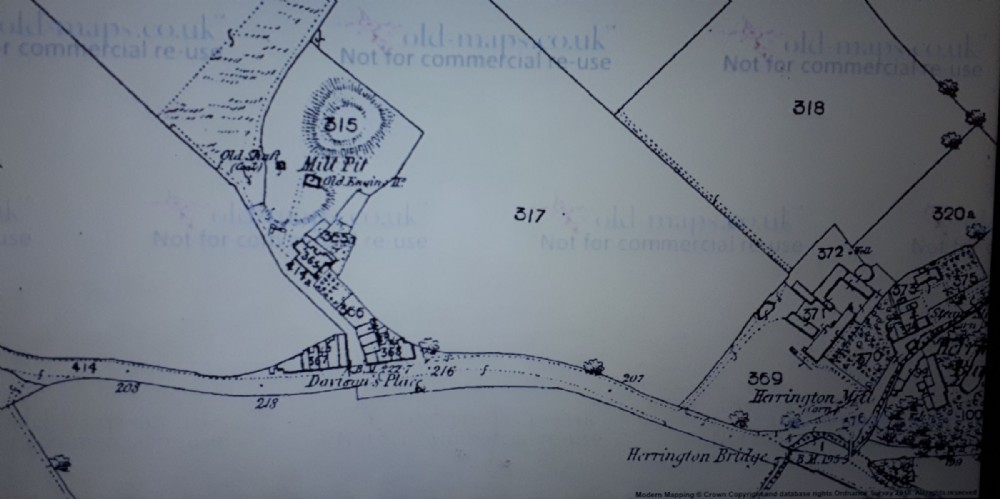
Mill Pit 1860 map
Sometimes listed as Herrington Mill Pit, Herrington Mill was located bottom right. There is very little information on the Durham Miners website http://www.dmm.org.uk/colliery/m035.htm especially owners? whether the mine was owned by the nearby Mill is at present unknown, There was also another Mill nearby on the main road to Penshaw Monument.
Like most mines this one had a terrible Disaster. In 1812, 19 Boys and 4 Men were killed in an explosion, with many other severely injured. The nearby St Oswalds Church which this map predates has a memorial to The Lives lost at this mine.
No dates are given for the opening or closure, But is possible it had already closed by 1860?As old Engine is shown. It looks to be a primitive mine which shows no links to any wagonways.
The 1st building below the mine "building 365" still shows up on later maps although much disfigured and altered, are today part of workshops.

This photograph is by lyons and was uploaded August 5th 2018. © lyons please do not copy or distribute without prior express permission.
Rating
Nobody has rated this photograph yet, why not be the first?
Copy & Paste Forum Code
To display this photograph in a forum message please copy the text below and paste it into your forum message:
[photo]115755[/photo]
To display this photograph in a forum message and link to the full size image please copy the text below and paste it into your forum message:
[link]115755[linkphoto]115755[/linkphoto][/link]