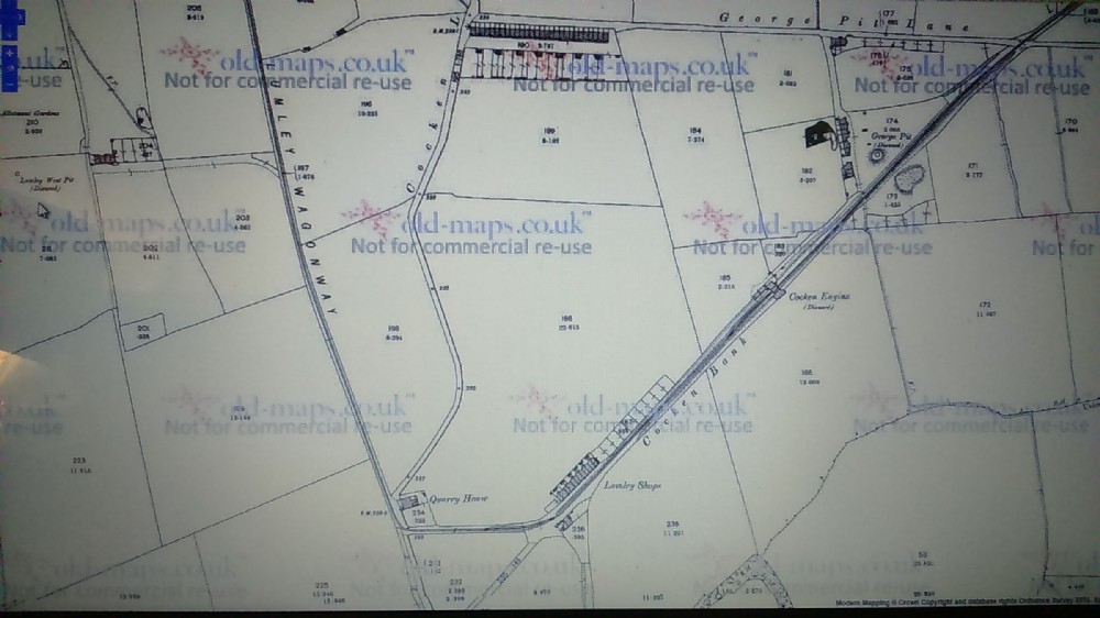
Lumley George Pit and Charles Pit Houses 1874map
Map showing continuation from the 8th Pit, with the next in line George Pit, already marked disused, (though the shaft and possibly ruin of engine house shows on 1959 map) along with the Cocken Haulage engine, although the Lumley shops (further down the Wagonway) survive The 1920s disappearing from the 1940 map.
However Charles Pit Houses (no mention of such a Mine according to The Durham Mining Museum http://www.dmm.org.uk/collnear/l009.htm) Does appear to have been linked to the wagonway (marks look like disused railway on the maps) shows no mention of a shaft? although there is a shaft to the left marked disused (not in the picture) along with drift well?
This part back to the part of the George Pit was Heavily Open Casted in The 1990s removing most of the Wagonway former path along with any trace of the "Shops" and Haulage engine.
Following the Wagonway North there is The West Pit (far left above the curser), This again is marked Disused and its short link to the Wagonway removed (no trace of the shaft today) though marked as Air shaft 1959 map,
The row of Houses (Lumley Terrace ) lasted until the 1959 map (now an allotment area) but part of George Pit Lane still survives as a gravel track.

This photograph is by lyons and was uploaded October 18th 2016. © lyons please do not copy or distribute without prior express permission.
Rating
Nobody has rated this photograph yet, why not be the first?
Copy & Paste Forum Code
To display this photograph in a forum message please copy the text below and paste it into your forum message:
[photo]108797[/photo]
To display this photograph in a forum message and link to the full size image please copy the text below and paste it into your forum message:
[link]108797[linkphoto]108797[/linkphoto][/link]