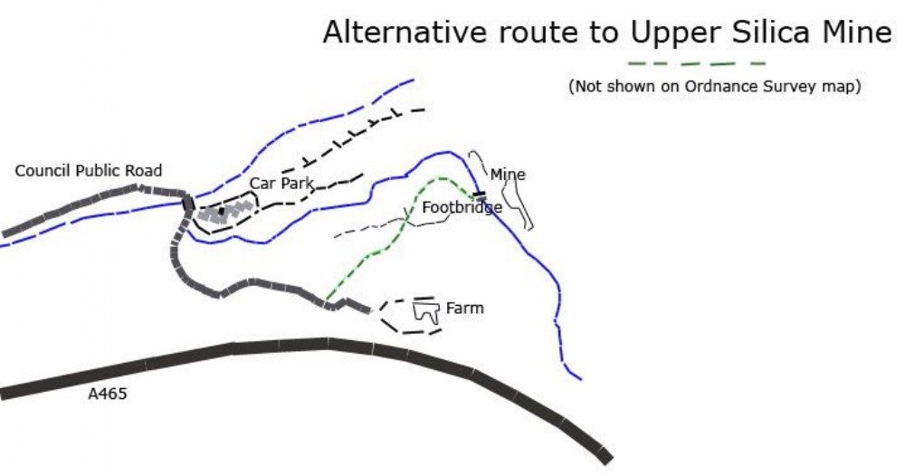
Alternative route to Upper Silica Mine
The road to the farm is a public road and the broken green line shows a public right of way that is not shown on Ordnance Survey maps. This would provide an easier route to the mine for people such as divers who have heavy equipment to carry.

This photograph is by royfellows and was uploaded April 26th 2017. © royfellows please do not copy or distribute without prior express permission.
Rating
Nobody has rated this photograph yet, why not be the first?
Copy & Paste Forum Code
To display this photograph in a forum message please copy the text below and paste it into your forum message:
[photo]111431[/photo]
To display this photograph in a forum message and link to the full size image please copy the text below and paste it into your forum message:
[link]111431[linkphoto]111431[/linkphoto][/link]