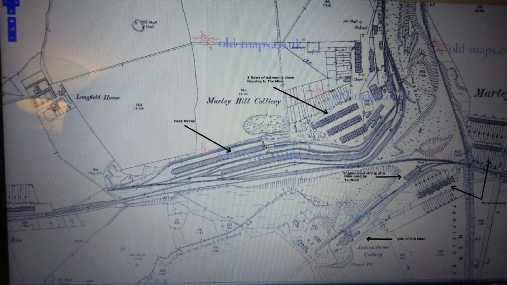
1896 map
Marley Hill Colliery (re opened 1841 (abandoned 1815) closed 1983) and Andrews House (lower Right opened 1843, closed 1920) Showing The Bowes Railway cutting through the centre (West to Byermoor - Hobson (Burnopfield) -Dipton - Pontop. East to Kibblesworth, Springwell ) The huge amount of Coke Ovens Dominates the map (All 330 of them) which also dwarfs the Mine. note how close the Housing is to all the activity which appears to be located within the Pit Yard, including a School (near an Air Shaft) and Chapel (top right) Whilst Andrews House looks a tiny concern (Both owned by John Bowes)

This photograph is by lyons and was uploaded September 27th 2015. © lyons please do not copy or distribute without prior express permission.
Rating
Nobody has rated this photograph yet, why not be the first?
Copy & Paste Forum Code
To display this photograph in a forum message please copy the text below and paste it into your forum message:
[photo]102313[/photo]
To display this photograph in a forum message and link to the full size image please copy the text below and paste it into your forum message:
[link]102313[linkphoto]102313[/linkphoto][/link]