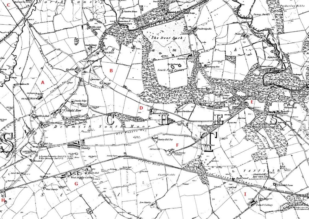
1861 area map
Area Map showing surrounding Mines, As is usual in The Durham Coal field it is littered with Mines, shafts and Railway Lines.
Area A Old Shield Row Colliery, a number of shafts in this area, Heavily wooded area now but the railway lines are now the Consett to Sunderland Walk, lots of old Bridges still in place.
B number of unnamed old shafts, another tree planted area very close to the former railway line.
C Tanfield Mines The very top not quite in view East Tanfield (now Tanfield Railway !) also just above area A was the Tanfield Lea, now an Ind estate, a vent Pipe still remains from the shaft.
D Beamish Mary, marked simply as Beamish.
E Beamish 2nd Pit with a number of shafts connected to that mine.
F East Stanley Colliery, other than part of the former wagon way, very little evidence of a Mine, The site is now back to a famers field.
G West Stanley Colliery (Burns Pit) This had a horrific Mining Disaster, a memorial is on site otherwise little evidence of its past.
H Louisa Colliery Not quite in View, Asda now forms part of the site.
I Twizzle Colliery, now a Chicken farm, Handon Hold Colliery was to the east of this.

This photograph is by lyons and was uploaded July 19th 2014. © lyons please do not copy or distribute without prior express permission.
Rating
Nobody has rated this photograph yet, why not be the first?
Copy & Paste Forum Code
To display this photograph in a forum message please copy the text below and paste it into your forum message:
[photo]95719[/photo]
To display this photograph in a forum message and link to the full size image please copy the text below and paste it into your forum message:
[link]95719[linkphoto]95719[/linkphoto][/link]