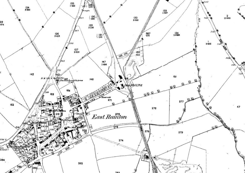
1856 map
The Railway lines cutting through the map shows the nearby Hazard Pit just off the page to the south, whilst the top of the page ended near the Durham Road to a Coal Depot (remains of brick wall near the road) whilst The mine itself looks a small concern dwarfed by the newer Hazard Pit.

This photograph is by lyons and was uploaded August 1st 2014. © lyons please do not copy or distribute without prior express permission.
Rating
Nobody has rated this photograph yet, why not be the first?
Copy & Paste Forum Code
To display this photograph in a forum message please copy the text below and paste it into your forum message:
[photo]95924[/photo]
To display this photograph in a forum message and link to the full size image please copy the text below and paste it into your forum message:
[link]95924[linkphoto]95924[/linkphoto][/link]