Wheal Jane (Goldfields / Rtz / Carnon / West Wh.Jane) Tin Mine (United Kingdom)
Information, history photographs (current and archive) and documents for Wheal Jane (Goldfields / Rtz / Carnon / West Wh.Jane) Tin Mine.
Photos of Wheal Jane (Goldfields / Rtz / Carnon / West Wh.Jane) Tin Mine
Historic Photographs Of Wheal Jane
(23 photos)
Last updated September 20th 2019 by
christwigg

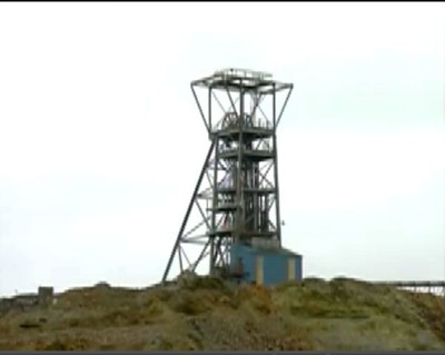
Photographs Of Wheal Jane
(9 photos)
Last updated August 2nd 2011 by
LeeW
Google Earth Map of Wheal Jane (Goldfields / Rtz / Carnon / West Wh.Jane) Tin Mine
Other location/mapping information:
Latitude: 50.2414
Longitude: -5.12182
Landranger grid reference: SW775426
Easting: 177500
Northing: 042600