Wheal Grenville United Mixed Mine (United Kingdom)
Parish: CAMBORNE
Data courtesy of Roy Fellows and Roy Morton
Photos of Wheal Grenville United Mixed Mine
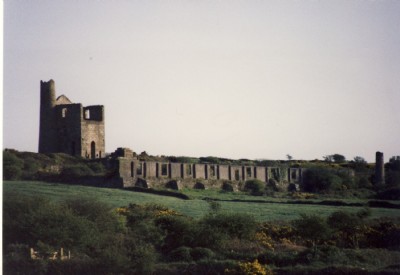
Photographs Of Grenville Utd.Mines
(2 photos)
Last updated June 18th 2010 by
spitfire

Historic Photographs Of Grenville Utd.Mines
(0 photos)
Last updated December 31st 2007 by
royfellows
Google Earth Map of Wheal Grenville United Mixed Mine
Other location/mapping information:
Latitude: 50.2021
Longitude: -5.27483
Landranger grid reference: SW664387
Easting: 166400
Northing: 038700