Wharton Hall Colliery Coal Mine (United Kingdom)
Information, history photographs (current and archive) and documents for Wharton Hall Colliery Coal Mine.
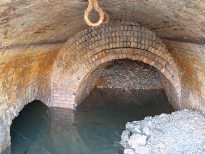
Photos of Wharton Hall Colliery Coal Mine
Photographs Of Wharton Hall Colliery
(5 photos)
Last updated July 26th 2011 by
Morrisey

Historic Photographs Of Wharton Hall Colliery
(0 photos)
Last updated March 11th 2009 by
ICLOK
Google Earth Map of Wharton Hall Colliery Coal Mine
Other location/mapping information:
Latitude: 53.5255
Longitude: -2.44645
Landranger grid reference: SD705033
Easting: 370500
Northing: 403300