Wadsley Common Ganister & Coal Mixed Mine (United Kingdom)
Information, history photographs (current and archive) and documents for Wadsley Common Ganister & Coal Mixed Mine.
Photos of Wadsley Common Ganister & Coal Mixed Mine
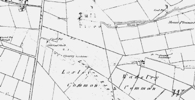
Historic Photographs Of Wadsley Common Ganister & Coal
(1 photo)
Last updated August 25th 2013 by
skiprat

Photographs Of Wadsley Common Ganister & Coal
(0 photos)
Last updated October 24th 2011 by
LeeW
Google Earth Map of Wadsley Common Ganister & Coal Mixed Mine
Other location/mapping information:
Latitude: 53.4119560989238
Longitude: -1.53809052963696
Landranger grid reference: SK307907
Easting: 430700
Northing: 390700