Upper Golconda Lead Mine (United Kingdom)
Information, history photographs (current and archive) and documents for Upper Golconda Lead Mine.
Photos of Upper Golconda Lead Mine
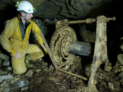
Photographs Of Golconda (Upper)
(19 photos)
Last updated October 5th 2010 by
Mr Mike

Historic Photographs Of Golconda (Upper)
(0 photos)
Last updated August 14th 2007 by
LeeW
Google Earth Map of Upper Golconda Lead Mine
Other location/mapping information:
Latitude: 53.092230369805
Longitude: -1.62814004874655
Landranger grid reference: SK249551
Easting: 424900
Northing: 355100