Troopers Hill Sandstone Quarry (United Kingdom)
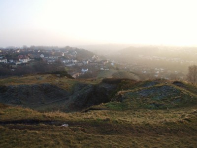
The shape of Troopers Hill today is mainly due to the quarrying of pennant sandstone for use in building. The 1890 Ordnance Survey map shows the quarry in an area now known as 'the gully'. The humps between the gully and Troopers Hill Road are tipped waste from this quarry.
Photos of Troopers Hill Sandstone Quarry
Photographs Of Troopers Hill
(1 photo)
Last updated January 10th 2009 by
ICLOK

Historic Photographs Of Troopers Hill
(0 photos)
Last updated January 10th 2009 by
ICLOK
Google Earth Map of Troopers Hill Sandstone Quarry
Other location/mapping information:
Latitude: 51.4557
Longitude: -2.53534
Landranger grid reference: ST629731
Easting: 362900
Northing: 173100