Tibshelf Old Bottom Coal Colliery (United Kingdom)
Information, history photographs (current and archive) and documents for Tibshelf Old Bottom Coal Colliery.
Photos of Tibshelf Old Bottom Coal Colliery
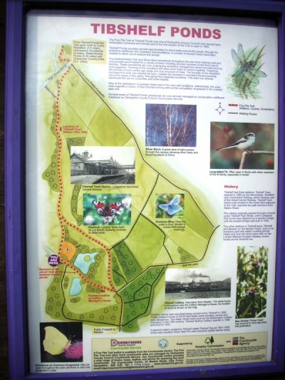
Photographs Of Tibshelf Old Colliery
(4 photos)
Last updated March 22nd 2011 by
LeeW

Historic Photographs Of Tibshelf Old Colliery
(0 photos)
Last updated August 14th 2007 by
LeeW
Google Earth Map of Tibshelf Old Bottom Coal Colliery
Other location/mapping information:
Latitude: 53.1362
Longitude: -1.33928
Landranger grid reference: SK443601
Easting: 444300
Northing: 360100