Swanwick (New) Colliery Coal Mine (United Kingdom)
Information, history photographs (current and archive) and documents for Swanwick (New) Colliery Coal Mine.
Photos of Swanwick (New) Colliery Coal Mine
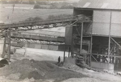
Historic Photographs Of Swanwick Colliery
(9 photos)
Last updated February 27th 2017 by
ianh67
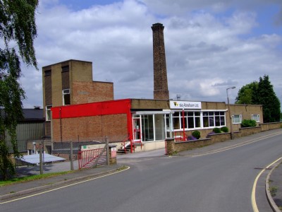
Photographs Of Swanwick Colliery
(4 photos)
Last updated August 19th 2012 by
Banjoman
Google Earth Map of Swanwick (New) Colliery Coal Mine
Other location/mapping information:
Latitude: 53.0879
Longitude: -1.38033
Landranger grid reference: SK416547
Easting: 441600
Northing: 354700