Slingtor (Slinter Tor) (Owlet Hole) Lead Mine (United Kingdom)
On some maps this vein(s) is shown as Slingtor or Owlet Hole, whilst another shows Slingtor and Owlet Hole as separate veins.
Photos of Slingtor (Slinter Tor) (Owlet Hole) Lead Mine
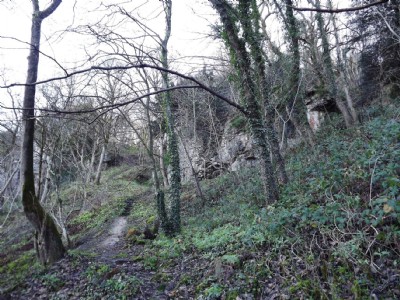
Photographs Of Slinter Tor (Owlet Hole)
(6 photos)
Last updated December 10th 2012 by
LeeW

Historic Photographs Of Slinter Tor (Owlet Hole)
(0 photos)
Last updated December 5th 2012 by
LeeW
Google Earth Map of Slingtor (Slinter Tor) (Owlet Hole) Lead Mine
Other location/mapping information:
Latitude: 53.1091148115384
Longitude: -1.5697281969912
Landranger grid reference: SK288570
Easting: 428800
Northing: 357000