Ryder Point Limestone Quarry (United Kingdom)
At base of CHPR Hopton Incline on North Side line. Directly east of Bonemill quarry.
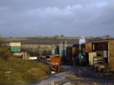
Photos of Ryder Point Limestone Quarry
Photographs Of Ryder Point
(2 photos)
Last updated November 20th 2008 by
ICLOK

Historic Photographs Of Ryder Point
(0 photos)
Last updated November 20th 2008 by
ICLOK
Google Earth Map of Ryder Point Limestone Quarry
Other location/mapping information:
Latitude: 53.0898
Longitude: -1.61174
Landranger grid reference: SK261548
Easting: 426100
Northing: 354800