Royal Polberro Consols Mixed Mine (United Kingdom)
Parish: ST.AGNES
Data courtesy of Roy Fellows and Roy Morton
Photos of Royal Polberro Consols Mixed Mine
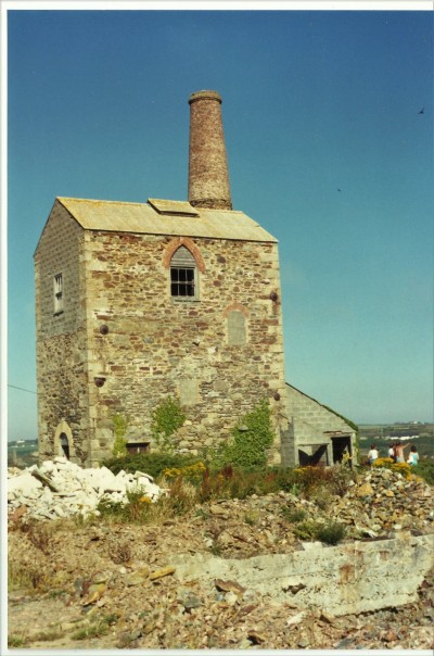
Photographs Of Polberro Consls.Royal
(2 photos)
Last updated January 16th 2021 by
tracyclimber

Historic Photographs Of Polberro Consls.Royal
(0 photos)
Last updated December 31st 2007 by
royfellows
Google Earth Map of Royal Polberro Consols Mixed Mine
Other location/mapping information:
Latitude: 50.3191
Longitude: -5.20981
Landranger grid reference: SW716515
Easting: 171600
Northing: 051500