Polladras Downs Tin Mine (United Kingdom)
Worked with Wheal Vor,
Output part of Wheal Vor.
Grid Ref from Squazz.
Photos of Polladras Downs Tin Mine
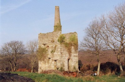
Photographs Of Polladras (Downs)
(1 photo)
Last updated July 20th 2008 by
ICLOK

Historic Photographs Of Polladras (Downs)
(0 photos)
Last updated December 31st 2007 by
royfellows
Google Earth Map of Polladras Downs Tin Mine
Other location/mapping information:
Latitude: 50.1301
Longitude: -5.33849
Landranger grid reference: SW615309
Easting: 161500
Northing: 030900