Pantyffynnon Colliery Coal Mine (United Kingdom)
Information, history photographs (current and archive) and documents for Pantyffynnon Colliery Coal Mine.
Photos of Pantyffynnon Colliery Coal Mine
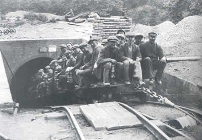
Historic Photographs Of Pantyffynnon Colliery
(1 photo)
Last updated February 1st 2011 by
Dai the Pitman

Photographs Of Pantyffynnon Colliery
(0 photos)
Last updated February 3rd 2009 by
ICLOK
Google Earth Map of Pantyffynnon Colliery Coal Mine
Other location/mapping information:
Latitude: 51.7797
Longitude: -4.00037
Landranger grid reference: SN621109
Easting: 262100
Northing: 210900