Moylgrove Trial Levels (Ceibwr Trial) Lead Mine (United Kingdom)
Up the Nant Ceibwr from the village is the small trial mine of moylgrove. Possibly looking for lead? Best approached from the cairn on the footpath and down the slope at the old farm.
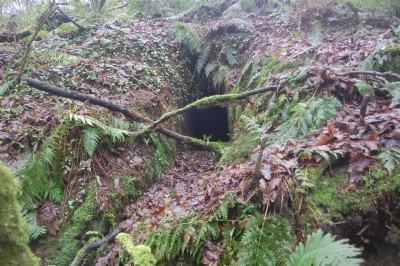
The level is a few meters above the river and heading in to the hill toward the church.
The adit is narrow and a foot deep in water for a few meters before the passage changes course and some shale run in leads up to a chamber. A cross roads is met. Left takes one to a dead end after five or so meters, right is back to the surface via the second level portal that is now nearly blocked and straight on leads to a very muddy passage that is blocked by mud. On the surface one will find a sinkhole where the level below has failed. Another possibility is that the sinkhole is an air shaft filled with mud and that miles of passage are beyond the mud choke……
Further down stream is a possible blocked adit with water issuing from its base.
Photos of Moylgrove Trial Levels Lead Mine
Photographs Of Moylgrove Trial Levels
(5 photos)
Last updated January 10th 2017 by
P Knight

Historic Photographs Of Moylgrove Trial Levels
(0 photos)
Last updated January 10th 2017 by
P Knight
Google Earth Map of Moylgrove Trial Levels Lead Mine
Other location/mapping information:
Latitude: 52.0683964303657
Longitude: -4.7388296292799
Landranger grid reference: SN123447
Easting: 212300
Northing: 244700