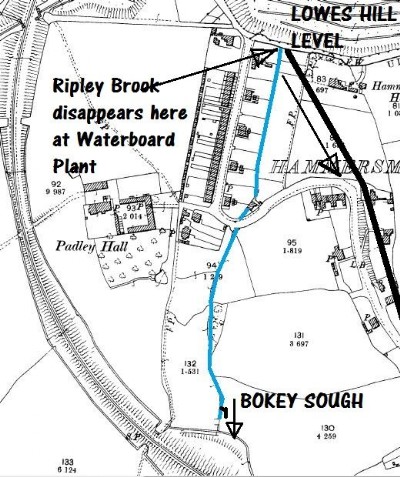
Lowes Hill Level (Lowes Hill Sough) Coal Mine (United Kingdom)
Level recorded by Twigg of Chesterfield in 1827 as driven to drain Ripley Top Coal.
Photos of Lowes Hill Level Coal Mine
Photographs Of Lowes Hill Level
(1 photo)
Last updated December 26th 2010 by
ICLOK

Historic Photographs Of Lowes Hill Level
(0 photos)
Last updated December 26th 2010 by
ICLOK
Google Earth Map of Lowes Hill Level Coal Mine
Other location/mapping information:
Latitude: 53.0593
Longitude: -1.41058
Landranger grid reference: SK396515
Easting: 439600
Northing: 351500