Home > Mines, Quarries & Sites > Loughtor Quarry Copper Mine

Loughtor Quarry Copper Mine (United Kingdom)


Information, history photographs (current and archive) and documents for Loughtor Quarry Copper Mine.

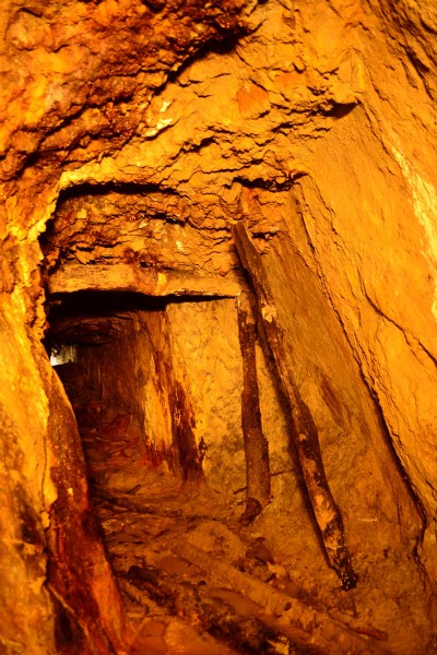
Photos of Loughtor Quarry Copper Mine

Photographs Of Loughtor Quarry
Photographs Of Loughtor Quarry (2 photos)
Last updated August 20th 2014 by s-10
Historic Photographs Of Loughtor Quarry
Historic Photographs Of Loughtor Quarry (0 photos)
Last updated March 16th 2009 by ICLOK

Google Earth Map of Loughtor Quarry Copper Mine


Other location/mapping information:

Latitude: 50.4021
Longitude: -4.04169
Landranger grid reference: SX550578
Easting: 255000
Northing: 057800

Documents for Loughtor Quarry Copper Mine

Sorry, there are no documents currently available. If you have any documents you can share please click the 'Upload a Document' tab.

Major Mining Region


Loughtor Quarry Copper Mine belongs to the Tamar Valley region.

See also:

Loughtor Quarry Copper Mine was served by:

Par Port

See more:

All copper mines in United Kingdom (SX)
All copper mines in United Kingdom