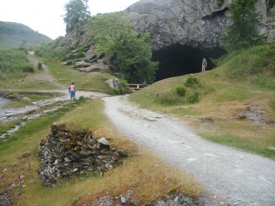
Loughrigg Fell (Rydal Cave) Slate Mine (United Kingdom)
A small selection of cave workings and now collapsed closeheads (save one) on Loughrigg Fell. Closed about 1920.
Photos of Loughrigg Fell (Rydal Cave) Slate Mine
Photographs Of Loughrigg Fell (Rydal Cave)
(17 photos)
Last updated March 5th 2014 by
LAP

Historic Photographs Of Loughrigg Fell (Rydal Cave)
(0 photos)
Last updated June 10th 2007 by
LAP
Google Earth Map of Loughrigg Fell (Rydal Cave) Slate Mine
Other location/mapping information:
Latitude: 54.4444
Longitude: -2.99611
Landranger grid reference: NY355059
Easting: 335500
Northing: 505900