Lord Nelson's Level Lead Mine (United Kingdom)
Information, history photographs (current and archive) and documents for Lord Nelson's Level Lead Mine.
Photos of Lord Nelson's Level Lead Mine
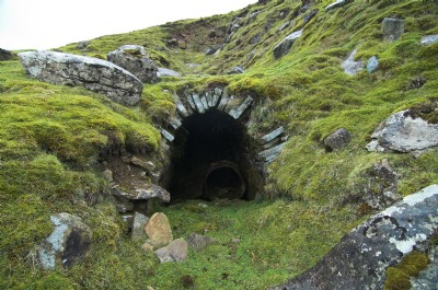
Photographs Of Lord Nelson's Level
(1 photo)
Last updated September 7th 2019 by
rikj
Google Earth Map of Lord Nelson's Level Lead Mine
Other location/mapping information:
Latitude: 54.0969587852888
Longitude: -1.9713677507979
Landranger grid reference: SE018668
Easting: 401800
Northing: 466800