Lady Rashleigh Consols Mixed Mine (United Kingdom)
Parish: LUXULYAN
Data courtesy of Roy Fellows and Roy Morton.
Grid ref from Squazz.
Comment from LeeW
I am not sure about the Grid Ref.The office building and saw pit are at SX064565
Photos of Lady Rashleigh Consols Mixed Mine
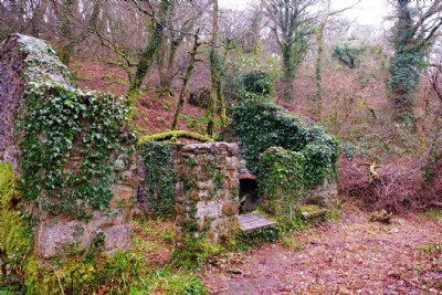
Photographs Of Lady Rashleigh Cons.
(8 photos)
Last updated November 7th 2020 by
Scoggan

Historic Photographs Of Lady Rashleigh Cons.
(0 photos)
Last updated December 31st 2007 by
royfellows
Google Earth Map of Lady Rashleigh Consols Mixed Mine
Other location/mapping information:
Latitude: 50.3730191480468
Longitude: -4.72998722294794
Landranger grid reference: SX059562
Easting: 205900
Northing: 056200