International Colliery Coal Mine (United Kingdom)
Information, history photographs (current and archive) and documents for International Colliery Coal Mine.
Photos of International Colliery Coal Mine
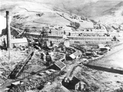
Historic Photographs Of International Colliery
(1 photo)
Last updated February 1st 2011 by
Dai the Pitman

Photographs Of International Colliery
(0 photos)
Last updated February 3rd 2009 by
ICLOK
Google Earth Map of International Colliery Coal Mine
Other location/mapping information:
Latitude: 51.6556
Longitude: -3.59443
Landranger grid reference: SS898964
Easting: 289800
Northing: 196400