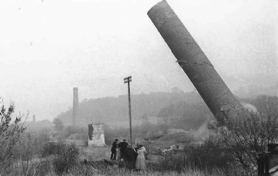
Grosmont Ironworks Iron Smelt Mill (United Kingdom)
Grosmont Ironworks built in 1862 and demolished in 1892.
Photos of Grosmont Ironworks Iron Smelt Mill
Historic Photographs Of Grosmont Ironworks
(3 photos)
Last updated February 3rd 2020 by
edjones

Photographs Of Grosmont Ironworks
(4 photos)
Last updated May 17th 2015 by
christwigg
Google Earth Map of Grosmont Ironworks Iron Smelt Mill
Other location/mapping information:
Latitude: 54.4367364271915
Longitude: -0.726141214663842
Landranger grid reference: NZ826053
Easting: 482600
Northing: 505300