Goyt's (Goit's) Moss Sough (Goyte's) Coal Tunnel (United Kingdom)
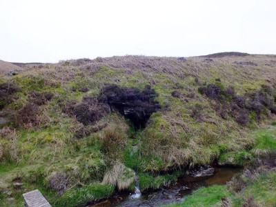
Adit which drains the upper section of the mines on Goyt's Moss. The adit drains a steady flow of water in to the River Goyt a short distance from Derbyshire Bridge.
Photos of Goyt's (Goit's) Moss Sough Coal Tunnel
Photographs Of Goyt's (Goit's) Moss Sough
(1 photo)
Last updated May 1st 2014 by
tarboat

Historic Photographs Of Goyt's (Goit's) Moss Sough
(0 photos)
Last updated April 30th 2014 by
LeeW
Google Earth Map of Goyt's (Goit's) Moss Sough Coal Tunnel
Other location/mapping information:
Latitude: 53.2456375124459
Longitude: -1.9730225691869
Landranger grid reference: SK018721
Easting: 401800
Northing: 372100