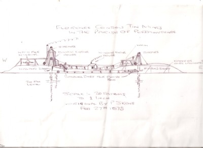
Florence Consols Mixed Mine (United Kingdom)
Parish: PER+S.HIL
Data courtesy of Roy Fellows and Roy Morton
Photos of Florence Consols Mixed Mine

Photographs Of Florence Consols
(9 photos)
Last updated January 28th 2014 by
Dave43
Historic Photographs Of Florence Consols
(1 photo)
Last updated April 19th 2013 by
Dave43
Google Earth Map of Florence Consols Mixed Mine
Other location/mapping information:
Latitude: 50.116
Longitude: -5.42145
Landranger grid reference: SW555296
Easting: 155500
Northing: 029600