East Holywell (Fenwick Pit) (Fenwick Pit) Coal Colliery (United Kingdom)
Information, history photographs (current and archive) and documents for East Holywell (Fenwick Pit) Coal Colliery.
Photos of East Holywell (Fenwick Pit) Coal Colliery
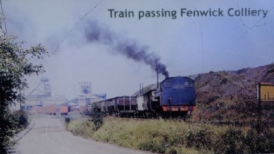
Historic Photographs Of Fenwick
(5 photos)
Last updated November 20th 2015 by
Lister
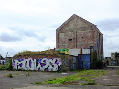
Fenwick Pit Visit
(42 photos)
Last updated August 29th 2013 by
ICLOK
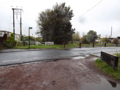
Photographs Of Fenwick
(22 photos)
Last updated October 13th 2011 by
LeeW
Google Earth Map of East Holywell (Fenwick Pit) Coal Colliery
Other location/mapping information:
Latitude: 55.0495498612643
Longitude: -1.51160893562825
Landranger grid reference: NZ312729
Easting: 431200
Northing: 572900