Coalhills (Coal Hills) Limestone Quarry (United Kingdom)
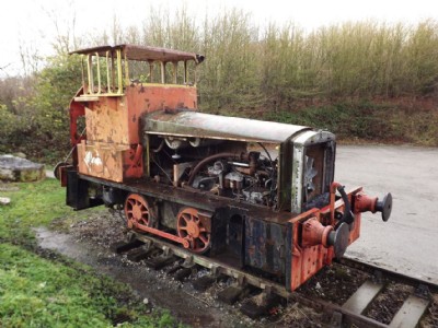
Quarry formerly connected to Cromford and High peak railway. It is situated near National stone centre car park and has a few interesting features inc what looks like a saddle tank from a loco upside down in use as a water tank and an interesting workers shelter built in a back wall in quarry. It is quite easy from the quarries layout to see how the mined stone was transhipped to the CHPR wagons as the rock cuttings to the quarry faces where the tracks were located are clearly defined. The quarry is also near the base of the CHPR Middleton incline where the incline rope return wheels etc are still in their pits and visible.
Photos of Coalhills Limestone Quarry
Photographs Of Coalhills
(35 photos)
Last updated September 10th 2016 by
gingerarchaeology

Historic Photographs Of Coalhills
(0 photos)
Last updated November 18th 2008 by
ICLOK
Google Earth Map of Coalhills Limestone Quarry
Other location/mapping information:
Latitude: 53.0942
Longitude: -1.57586
Landranger grid reference: SK285553
Easting: 428500
Northing: 355300