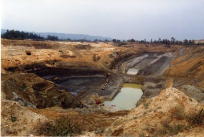
Chilmead Farm Fullers Earth Other Rock Pit (United Kingdom)
Operated in the 1980s-90s, now a huge landfill. Overlying silver sand deposit was also worked.
Photos of Chilmead Farm Fullers Earth Other Rock Pit
Historic Photographs Of Chilmead Farm Fullers Earth
(1 photo)
Last updated February 25th 2011 by
Peter Burgess

Photographs Of Chilmead Farm Fullers Earth
(0 photos)
Last updated February 25th 2011 by
Peter Burgess
Google Earth Map of Chilmead Farm Fullers Earth Other Rock Pit
Other location/mapping information:
Latitude: 51.2444
Longitude: -0.147508
Landranger grid reference: TQ294511
Easting: 529400
Northing: 151100