Caudledown Works Clay Quarry (United Kingdom)
Information, history photographs (current and archive) and documents for Caudledown Works Clay Quarry.
Photos of Caudledown Works Clay Quarry
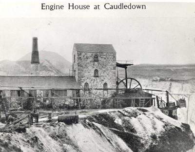
Historic Photographs Of Caudledown Works
(1 photo)
Last updated March 25th 2010 by
Dolcoathguy

Photographs Of Caudledown Works
(0 photos)
Last updated March 17th 2009 by
ICLOK
Google Earth Map of Caudledown Works Clay Quarry
Other location/mapping information:
Latitude: 50.3845
Longitude: -4.802
Landranger grid reference: SX009576
Easting: 200900
Northing: 057600