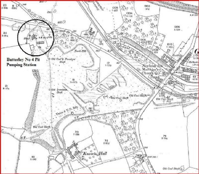
Butterley Park No 4 Pit (Butterley Park Pumping Station, New Main No 4) Coal Mine (United Kingdom)
Information, history photographs (current and archive) and documents for Butterley Park No 4 Pit Coal Mine.
Photos of Butterley Park No 4 Pit Coal Mine
Photographs Of Butterley Park No 4 Pit
(2 photos)
Last updated April 9th 2009 by
ICLOK

Historic Photographs Of Butterley Park No 4 Pit
(0 photos)
Last updated April 9th 2009 by
ICLOK
Google Earth Map of Butterley Park No 4 Pit Coal Mine
Other location/mapping information:
Latitude: 53.0573
Longitude: -1.37779
Landranger grid reference: SK418513
Easting: 441800
Northing: 351300