Bevercotes Colliery Coal Mine (United Kingdom)
Information, history photographs (current and archive) and documents for Bevercotes Colliery Coal Mine.
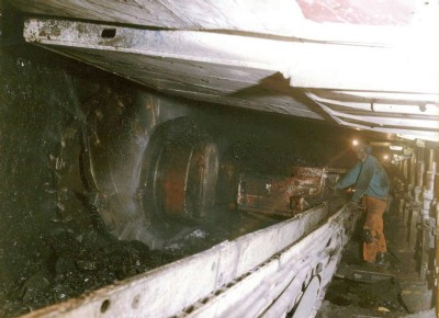
Photos of Bevercotes Colliery Coal Mine

Historic Photographs Of Bevercotes Colliery
(25 photos)
Last updated July 30th 2015 by
tarboat
Photographs Of Bevercotes Colliery
(2 photos)
Last updated October 8th 2014 by
Fletch5789
Google Earth Map of Bevercotes Colliery Coal Mine
Other location/mapping information:
Latitude: 53.2576
Longitude: -0.959656
Landranger grid reference: SK695739
Easting: 469500
Northing: 373900