Barnsley New Colliery Coal Colliery (United Kingdom)
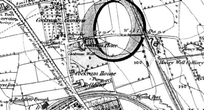
Small colliery shown on the 1850 OS map at the intersection of Honey Well Lane and what is now Cockerham Lane next to Cockram Gardens.
Photos of Barnsley New Colliery Coal Colliery
Historic Photographs Of Barnsley New Colliery
(1 photo)
Last updated August 13th 2013 by
skiprat

Photographs Of Barnsley New Colliery
(0 photos)
Last updated August 13th 2013 by
skiprat
Google Earth Map of Barnsley New Colliery Coal Colliery
Other location/mapping information:
Latitude: 53.5609731805351
Longitude: -1.48664256287671
Landranger grid reference: SE340073
Easting: 434000
Northing: 407300