Aberbaiden Colliery Coal Mine (United Kingdom)
Information, history photographs (current and archive) and documents for Aberbaiden Colliery Coal Mine.
Photos of Aberbaiden Colliery Coal Mine
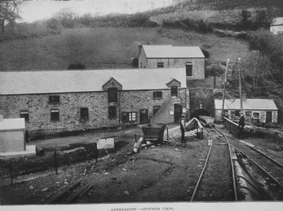
Historic Photographs Of Aberbaiden Colliery
(3 photos)
Last updated March 1st 2020 by
Morlock

Photographs Of Aberbaiden Colliery
(0 photos)
Last updated February 3rd 2009 by
ICLOK
Google Earth Map of Aberbaiden Colliery Coal Mine
Other location/mapping information:
Latitude: 51.5503
Longitude: -3.65998
Landranger grid reference: SS850848
Easting: 285000
Northing: 184800